

Flood Control
See how your property could be affected by flooding
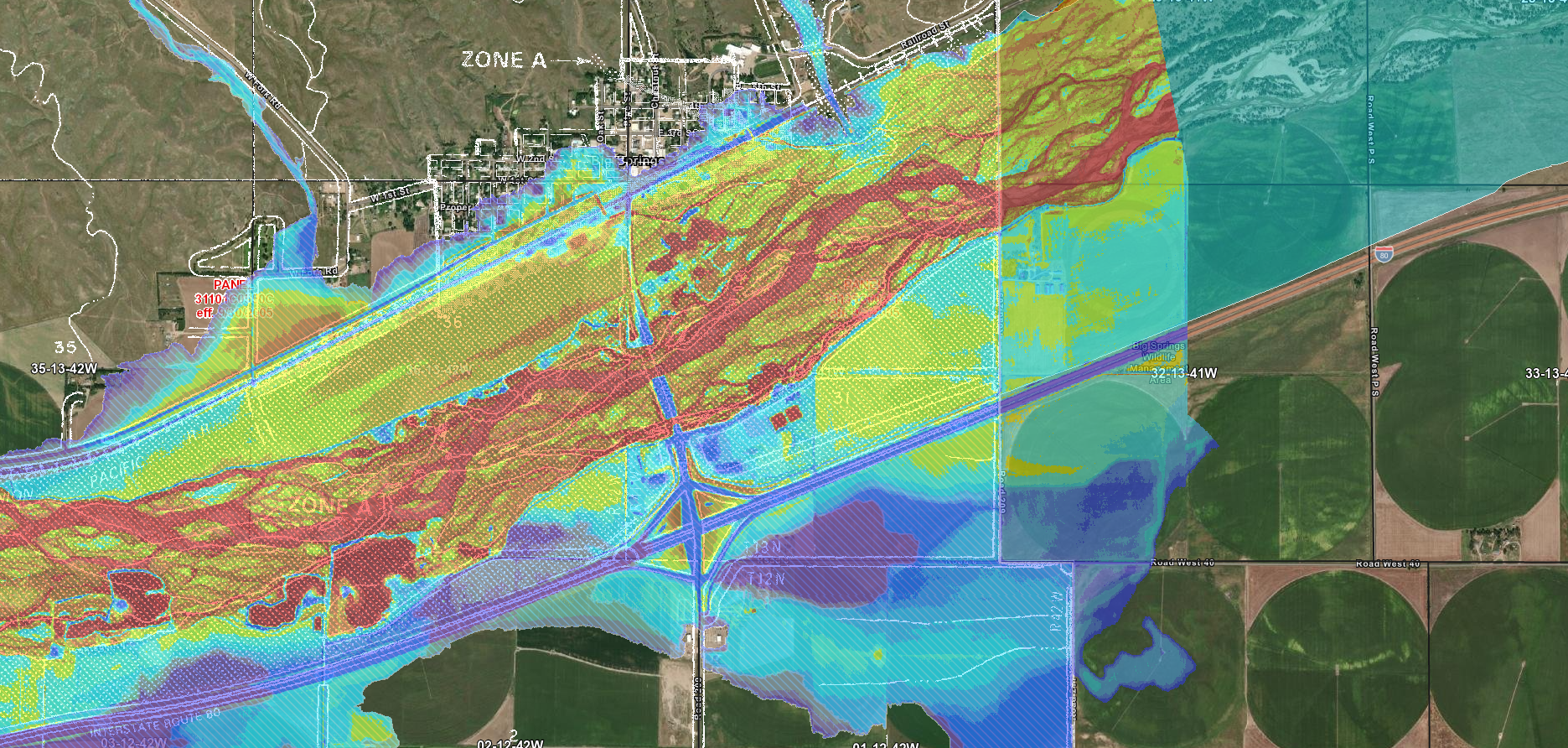
The Department of Natural Resources (DNR) works with NRDs to provide interactive maps showing possible percentages of flooding in an area.
Each year, flood control projects built by NRDs protect thousands of acres of land and hundreds of homes from damage by uncontrolled flood waters, saving millions of dollars in rebuilding costs. NRD technicians also help protect property and lives by inspecting a number of public and private dams throughout the district.
South Platte NRD Flood Control Projects
Sidney East Dam
Protects the city of Sidney from drainage from 134 acres north of town. Constructed in 1957-58, the dam is designed to contain a 21-inch rainfall over six hours.
Bushnell West
Built in 1983 about three miles northwest of Bushnell. It controls erosion from about 1,900 acres above Bushnell, protecting the town, county roads and cropland below.
McFee Road Structure
Protects a highly traveled Deuel County road from flooding, and protects the Chappell Landfill from runoff and erosion. It was built in 1993 about 1 1/2 miles north of Chappell.